|
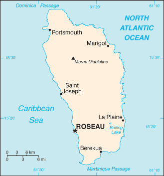
To the north-northwest lies Guadeloupe, to the southeast Martinique. Its size is 754 square kilometres (291 sq mi) and the highest point in the country is Morne Diablotins, which has an elevation of 1,447 metres (4,750 ft). The Commonwealth of Dominica has an estimated population of 72,500. The capital is Roseau. |

Official name: Commonwealth of Dominica Capital: Roseau Population: 72,660 (July 2009 est.) Area: 751 sq km Coastline: 148 km Religion: Roman Catholic 61.4%, Seventh Day Adventist 6%, Pentecostal 5.6%, Baptist 4.1%, Methodist 3.7%, Church of God 1.2%, Jehovah's Witnesses 1.2%, other Christian 7.7%, Rastafarian 1.3%, other or unspecified 1.6%, none 6.1% (2001 census) Language: English (official), French patois Ethnic groups: black 86.8%, mixed 8.9%, Carib Amerindian 2.9%, white 0.8%, other 0.7% (2001 census) Government: parliamentary democracy Currency: East Caribbean dollar |
English


