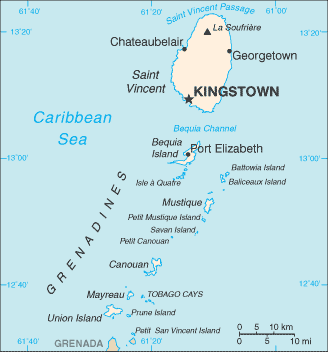
Saint Vincent and the Grenadines is a nation in the Lesser Antilles chain, which lies at the eastern border of the Caribbean Sea where it meets the Atlantic Ocean. Its 389-square-kilometre (150 sq mi) territory consists of the main island of Saint Vincent and the northern two-thirds of the Grenadines, which are a chain of smaller islands stretching south from Saint Vincent to Grenada. |
Name: St Vincent and the Grenadines Capital: Kingstown Populaton : 104,574 (July 2009 est.) Area: 389 sq km (Saint Vincent 344 sq km) Density: 302 inhab/ sq Km Religions: Anglican 47%, Methodist 28%, Roman Catholic 13%, other (includes Hindu, Seventh-Day Adventist, other Protestant) 12% Language: English, French patois Ethnic Group: black 66%, mixed 19%, East Indian 6%, European 4%, Carib Amerindian 2%, other 3% Government: Parliamentary democracy; independent sovereign state within the Commonwealth Currency: East Caribbean Dollar |
Comunicados de prensa más recientes
Islas Caimán, 31 de octubre de 2025. El CCRIF SPC anunció que hará un pago de US$70 millones al Gobierno de Jamaica tras el paso del huracán Melissa. Es el mayor pago único en la historia del CCRIF y una poderosa demostración del modelo de seguro paramétrico de la organización.
Gran Caimán, 18 de diciembre de 2024.