|
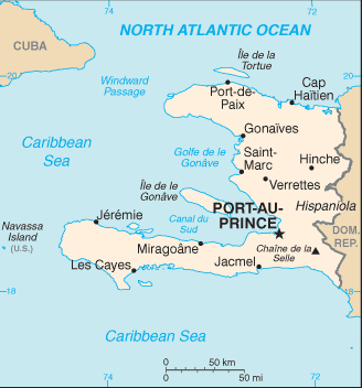
Along with the Dominican Republic, it occupies the island of Hispaniola, in the Greater Antillean archipelago. Ayiti (land of high mountains) was the indigenous Taíno or Amerindian name for the mountainous western side of the island. The country's highest point is Pic la Selle, at 2,680 metres (8,793 ft). The total area of Haiti is 27,750 square kilometres (10,714 sq mi) and its capital is Port-au-Prince. Haitian Creole and French are the official languages. |
Official Name: Conventional long form: Republic of Haiti. Local Long Form: Republique d'Haiti/Repiblik d' Ayiti. local short form: Haiti/Ayiti Ethnic Groups: black 95%, mulatto and white 5% Official Language: French (official), Creole (official) |
 Haiti (pronounced /ˈheɪtɪ/; French Haïti, pronounced: [a.iti]; Haitian Creole: Ayiti, Haitian Creole pronunciation: [ajiti]), officially the Republic of Haiti (République d'Haïti ; Repiblik Ayiti) is a Caribbean country.
Comunicados de prensa más recientes
Islas Caimán, 31 de octubre de 2025. El CCRIF SPC anunció que hará un pago de US$70 millones al Gobierno de Jamaica tras el paso del huracán Melissa. Es el mayor pago único en la historia del CCRIF y una poderosa demostración del modelo de seguro paramétrico de la organización.
Gran Caimán, 18 de diciembre de 2024.